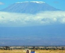
The short answer is that the temperatures on Mount Kilimanjaro range from hot to bitter cold. The journey from the gate to the peak is like traveling from the equator to Antarctica in a matter of days. This is because the routes to the Uhuru peak cross different ecological zones. Mount Kilimanjaro has five major ecological zones, each approximately 3,280 feet (1,000 m) in altitude. Each zone is subject to a corresponding decrease in rainfall, temperature and life as the altitude increases.
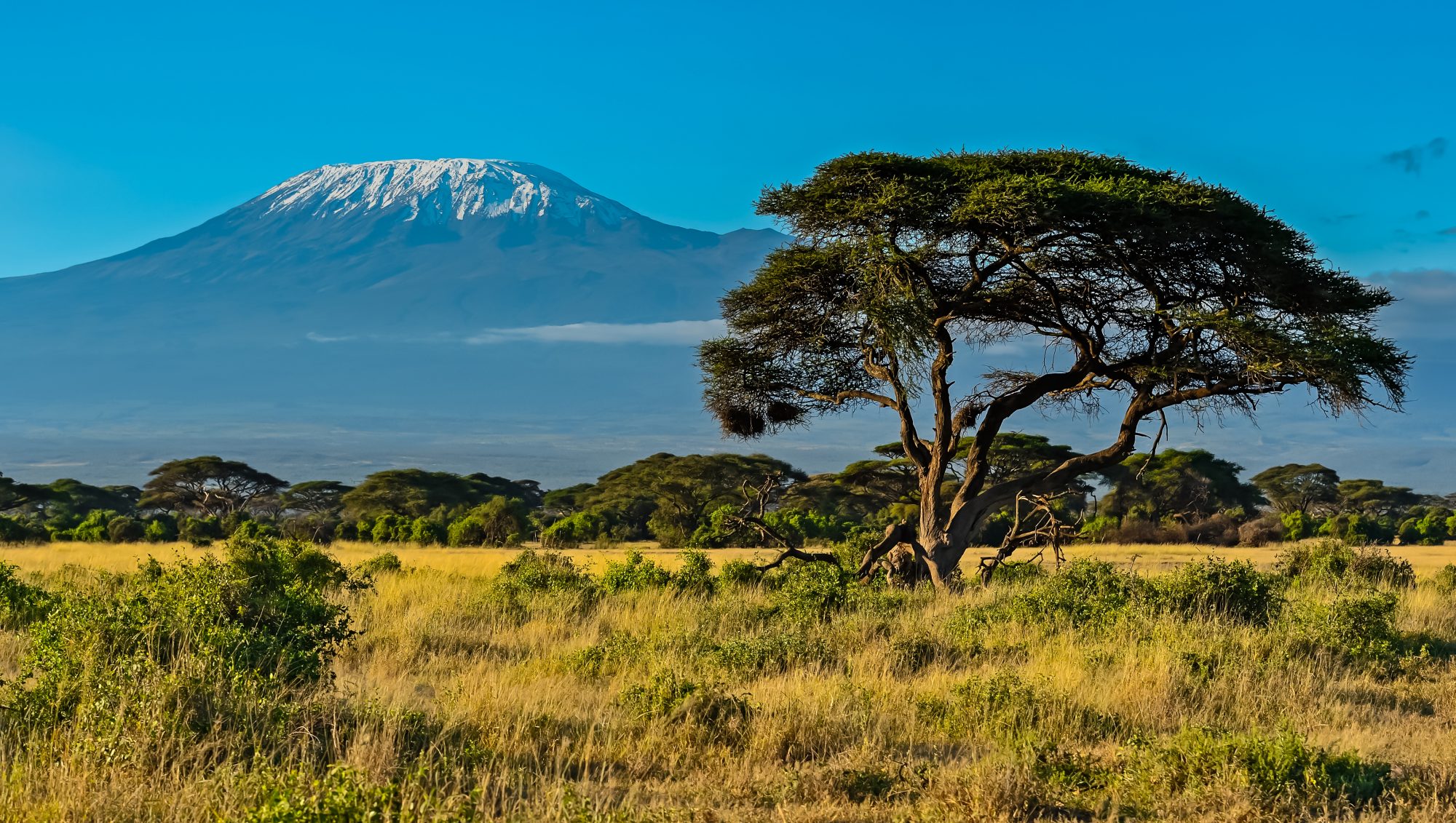
Moshi, the gateway town from which our climbs are organized, is located just south of the base of Mount Kilimanjaro. At 2,667 feet (900 m) above sea level, the town is located in the lowest, warmest ecological zone. Average temperature, humidity and precipitation figures for Moshi are reflected in the following table.
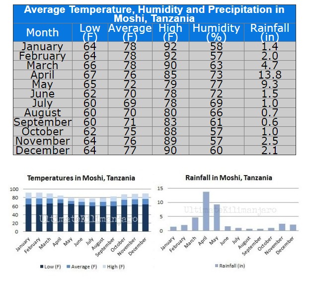
As shown, January and February are the warmest months, April and May are the wettest months, June and July are the coolest months, and August and September are the driest months. These generalities about the weather in Moshi hold true for Mount Kilimanjaro as well.
Due to its proximity to the equator, Mount Kilimanjaro does not experience wide temperature changes from season to season. Instead, the temperatures on Mount Kilimanjaro are determined more so by the altitude and time of day. At the beginning of the climb, at the base of the mountain, the average temperature is around 70 to 80 degrees Fahrenheit (21 to 27 degrees Celsius). From there, the temperatures will decrease as you move through Mount Kilimanjaro's ecological zones.
At the summit, Uhuru Point, the night time temperatures can range between 20 and -20 degrees Fahrenheit (-7 to -29 degrees Celsius). Due to Mount Kilimanjaro's great height, the mountain creates its own weather. It is extremely variable and impossible to predict. Therefore, regardless of when you climb, you should always be prepared for wet days and cold nights.
Below are the five zones from the lowest to the highest altitude along with the average annual precipitation, zone characteristics, and links/feeds to the current weather in each particular zone.
 Bushland BushlandAltitude: 2,600 to 6,000 ft (800 to 1,800 m) Precipitation: 20 to 70 in (500 to 1,800 mm) Cultivated land, grasslands and populated human settlements characterize this zone. |
 Rain Forest Rain ForestAltitude: 6,000 to 9,200 ft (1,800 to 2,800 m) Precipitation: 79 to 40 in (2,000 to 1,000 mm) The forest receives 6 feet of rain annually, supporting a variety of plants and wildlife while clear nights can produce low temperatures. |
 Heath HeathAltitude: 9,200 to 13,200 ft (2,800 to 4,000 m) Precipitation: 51 to 21 in (1,300 to 530 mm) This semi-alpine zone is characterized by heath-like vegetation and abundant wild flowers. The unique Senecio trees are abundant here. |
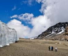
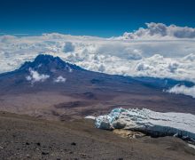
 Alpine Desert Alpine DesertAltitude: 13,200 to 16,500 ft (4,000 to 5,000 m) Precipitation: 10 in (250 mm) The alpine desert receives little water and correspondingly light vegetation exists here. The temperature can vary from over 100 degrees Fahrenheit during the day to below freezing at night. |
 Arctic ArcticAltitude: 16,500+ ft (5,000+ m) Precipitation: <4 in (100 mm) Characterized by ice and rock, there is virtually no plant or animal life at this altitude. Nights are extremely cold and the day's unbuffered sun is powerful. The oxygen level is half that of sea level. |

Related Posts